A 200-Year-Old Border Dispute: Decoding the Latest India-Nepal Tensions
Nepal's Prime Minister Balendra Shah has reignited a long-standing border dispute with India by claiming that Nepal has also encroached on Indian territory. This article unpacks the historical roots of the conflict, focusing on the contested regions of Limpiyadhura, Lipulekh, and Kalapani. It explores the 1816 Sugauli Treaty, the cartographic ambiguities that fuel the disagreement, and the complex interplay of colonial legacies and modern geopolitics. We examine the reactions from India and within Nepal, analyzing what this means for bilateral relations and the potential path towards resolution.
The India-Nepal border, spanning over 1,800 kilometers, is one of the most open international boundaries in the world, fostering deep cultural and familial ties. Yet, a sliver of this frontier, nestled in the far-western Himalayas, has been a persistent source of friction for over two centuries. The recent parliamentary address by Nepal's Prime Minister Balendra Shah, asserting that Nepal has also encroached on Indian territory, has thrust this long-simmering dispute back into the international spotlight. This unprecedented statement signals a potential shift in Nepal's diplomatic posture, moving beyond its traditional accusations against India. The core of the conflict lies in a complex interplay of colonial-era treaties, ambiguous geography, and 21st-century geopolitics. This article delves into the intricacies of the dispute, examining its historical origins, the current flashpoints, and the implications for the future of one of South Asia's most important bilateral relationships.
The Genesis of the Conflict: The Treaty of Sugauli (1816)
The roots of the present disagreement are firmly planted in the colonial era, specifically the aftermath of the Anglo-Nepalese War (1814-1816). The war concluded with the signing of the Treaty of Sugauli between the Gorkha Kingdom of Nepal and the British East India Company. This treaty defined Nepal's western boundary, ceding territories 'west of the Kali River' to British India. However, the treaty, as historian Nishchal Pandey, director of the Kathmandu-based Centre for South Asian Studies, told Al Jazeera, "did not define where the river Kali originates from" and "did not have any map attached". This cartographic omission is the fundamental source of the present dispute. The British used maps from the early 19th century to administer the region, but these maps were often inconsistent. Nepal, as noted by former diplomat Lok Raj Baral, traditionally lacked its own survey maps and "depended on maps published by British India".
The Core Contested Territories: Limpiyadhura, Lipulekh, and Kalapani
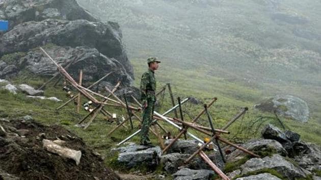
The area in dispute is a narrow, high-altitude strip encompassing three key points: Limpiyadhura, Lipulekh, and Kalapani. The disagreement hinges entirely on the true source of the Kali River. Nepal claims that the river originates at Limpiyadhura, the northernmost point. Consequently, they argue that the territory between Limpiyadhura and the tributary that India recognizes as the Kali belongs to Nepal. India, on the other hand, contends that the Kali River emerges at Lipulekh, further south, making the territory between the two rivers Indian. This region is not uninhabited wasteland; it holds significant strategic and religious importance. Indian troops have been stationed in Kalapani since the 1962 Sino-Indian War, a fact that underscores its strategic value. Furthermore, the Lipulekh Pass is a key route for the Kailash-Mansarovar pilgrimage, a journey of deep religious significance for Hindus, Buddhists, and Jains.
Balendra Shah's Controversial Statement and its Nuances
When Prime Minister Balendra Shah, a 35-year-old rapper-turned-politician, stated in parliament that "Not only has India encroached Nepali territory, but Nepal has also encroached Indian territory in many places", it caused an immediate uproar. He suggested both countries should "study the facts and sit together as friends and resolve the issue". This was a dramatic departure from the standard Nepali position, which has historically focused solely on Indian encroachment. The statement, however, was quickly clarified by Nepal's Ministry of Foreign Affairs. A statement from the ministry suggested Shah was referring to possible technical, local mismatches between legal borders and actual land usage, or "cross-border occupation", such as Nepali citizens farming on land legally belonging to India. This nuanced interpretation attempted to walk back the more provocative reading of the PM's remarks.

Reactions from New Delhi and Kathmandu
The response from India was swift and decisive. Ministry of External Affairs spokesperson Randhir Jaiswal reiterated that bilateral mechanisms exist to handle the issue and firmly rejected any third-party intervention. He stated, "We have established bilateral mechanisms to deal with all aspects of boundary matters." This was a direct response to Shah's mention of reaching out to the United Kingdom for historical maps. Within Nepal, the reaction was largely negative, particularly from opposition parties. Lawmaker Basana Thapa of the Nepali Congress party demanded clarification, while Ramesh Kumar Malla of the Communist Party called it a "derogatory statement about the country's national integrity". Former ambassador Nilambar Acharya outright rejected Shah's claim, stating unequivocally that no land of India has been encroached upon by the Nepali state. Political analyst Anurag Acharya warned that the PM's "'off-the-cuff' remarks on a diplomatically sensitive issue... will have serious consequences for Nepal in its bilateral negotiations".
The Geopolitical Chessboard: India, China, and the Third-Party Factor
The Kalapani dispute is not merely a bilateral issue; it is deeply entangled with the broader geopolitical rivalry between India and China. The region is a tri-junction, and India's military presence there is directly linked to its strategic concerns regarding China. Professor Dinesh Paudel observed that China would "not rush to make any remarks about Nepal" for now. Shah's invocation of British historical maps was seen by analysts like Paudel as a move that "will not go well with India". India has consistently and forcefully opposed any third-party involvement, a stance that was reinforced by the MEA's latest response. The visit of RSP lawmaker Rabi Lamichhane to India for talks with the ruling BJP signals that behind the tough talk, both nations are still seeking dialogue. Shah appears to be attempting to balance a nationalist domestic agenda with the pragmatic need for a functional relationship with India, its most important economic and strategic partner.
Looking Ahead: Dialogue and the Path to Resolution
The path to a permanent resolution remains fraught with difficulty. Previous attempts, such as the formation of a joint Eminent Persons Group (EPG) in 2016, failed due to a deep-seated "trust deficit". Prime Minister Shah's comments, while potentially creating a new kind of baggage for negotiators, have also highlighted the need for a pragmatic, data-driven approach. His suggestion to use 19th-century British survey maps, while politically controversial, could provide a framework for a fact-based discussion if both parties agree on their authenticity. Ultimately, resolving the border issue requires a delicate balance of historical evidence, modern diplomatic pragmatism, and political will. For both nations, the enormous benefits of a stable and cooperative relationship must outweigh the allure of nationalist chest-beating over a remote, high-altitude frontier. The world will be watching to see if the generation of young leaders in South Asia can solve a problem that has confounded their predecessors for 200 years.